
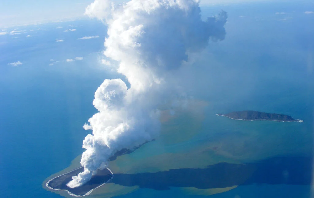
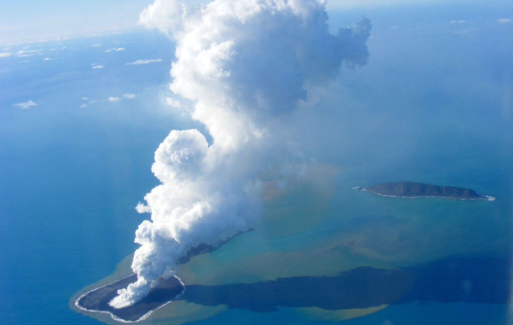
The 2022 eruption of the Hunga Tonga-Hunga Haʻapai volcano was more than just a geological event; it was a global phenomenon that recalibrated our understanding of planetary hazards. While the spectacular 55-kilometer-high eruption column—which injected massive volumes of water vapor into the stratosphere—dominated headlines, the true power of the event lay hidden beneath the waves. New post-eruption seafloor imaging has now revealed that the rapid, catastrophic collapse of the volcano’s caldera was the likely engine driving a record-breaking 40-meter-high tsunami. This discovery challenges long-held scientific assumptions about the destructive potential of "small" underwater volcanoes, suggesting that the ocean floor holds far more dangerous secrets than previously imagined.
The Lessons of History: From Krakatau to Hunga
To understand the gravity of the Hunga event, one must look back to the 1883 eruption of Krakatau in Indonesia. Historically, volcanic eruptions were associated with the hazards of falling tephra, pyroclastic flows, and toxic gases. However, the tragedy at Krakatau, which claimed over 30,000 lives, served as a grim reminder that the most lethal byproduct of an island volcano is often the displacement of water.
In the deep ocean, the sheer weight of the water column can act as a dampener, suppressing explosive activity. Conversely, as volcanoes approach the surface, the drop in pressure and the interaction between molten magma and seawater can lead to violent, steam-driven explosions. Yet, until now, the specific mechanism linking a caldera collapse to a massive, trans-oceanic tsunami remained poorly constrained. The study of the Hunga eruption provides the clearest evidence to date that a caldera does not need to be massive to be lethal; it only needs to collapse with sufficient speed and scale.
Chronology of a Catastrophe: January 15, 2022
The eruption on January 15, 2022, was a masterclass in geologic ferocity. The event began with a massive explosion that sent pressure waves rippling through the atmosphere, detectable by barometers across every continent on Earth.
The sequence of events, as reconstructed by researchers comparing 2015–2016 seafloor mapping with five high-resolution surveys conducted between April and October 2022, paints a picture of a structural failure occurring in real-time. The evidence suggests that as the volcano erupted, the underlying magma reservoir—a shallow chamber roughly two kilometers beneath the seafloor—began to empty.
The reservoir’s roof, a broad, four-to-five-kilometer-wide structure, was already precariously thin. Scientists calculate that a drop in pressure of just 30 megapascals—roughly 300 times atmospheric pressure—was enough to trigger a total structural failure. As the magma drained, the roof could no longer support the massive weight of the ocean above it. The caldera did not crumble piece-by-piece; it underwent a "piston-style" collapse, sinking downward as a single, cohesive unit. This abrupt displacement of nearly seven cubic kilometers of seafloor acted like a massive plunger, surging through the water column and generating a tsunami that reached unprecedented heights of 40 meters within 100 kilometers of the source.
Supporting Data: Mapping the Abyss
The ability to reconstruct this event was only possible due to a fortunate stroke of scientific timing. Because the Hunga volcano had formed a new island in 2014–2015, researchers had already established a high-resolution baseline map of the seafloor. By utilizing satellite imagery and NASA’s ICESat-2 laser altimetry, the team created a comprehensive 3D model that allowed them to visualize the "before and after" of the caldera.
The data revealed that before the eruption, the caldera floor sat at a depth of 150 to 200 meters. Following the collapse, the floor had plunged to a depth of 850 meters. When accounting for the 150 meters of volcanic debris that accumulated on top of the sunken floor, the total vertical subsidence is approximately one kilometer.
Seismic surveys further confirmed the timing of the collapse. By analyzing the layers of sediment, researchers discovered that landslide deposits from the crater walls were interspersed within the pyroclastic layers. If the collapse had occurred post-eruption, these deposits would sit exclusively on top. Their presence within the eruption layers is the "smoking gun" that proves the caldera was actively falling while the volcano was still erupting.
Official Scientific Perspectives and Global Implications
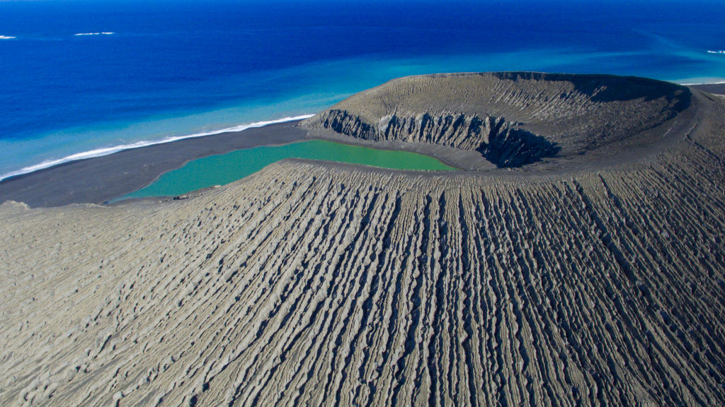
The research team, whose findings were published in Nature Geoscience, emphasizes that the Hunga volcano is not a geological outlier. It sits within the Tonga-Kermadec arc, a region teeming with at least 74 underwater volcanoes, 20 of which are complex caldera systems. Volcanoes like Tofua and Fonuafoʻou share structural similarities with Hunga, raising urgent questions about the safety of coastal communities in the Pacific.
The researchers note that the "piston-style" collapse observed at Hunga may have also created fault lines along the caldera rim. These fractures likely allowed massive amounts of seawater to penetrate the shallow magma reservoir, a process that potentially exacerbated the explosive nature of the eruption and facilitated the massive underwater avalanches of debris that further contributed to the tsunami’s energy.
The scientific consensus is shifting: the size of a caldera is less important than the geometry and speed of its collapse. A "small" caldera, if it falls deep enough and fast enough, can displace a volume of water equal to that of a significantly larger feature, creating a localized tsunami of immense power.
Protecting the Future: A Call to Action
The implications for global disaster mitigation are stark. The Hunga eruption highlighted a critical vulnerability in our current observation systems: the relative inaccessibility of the ocean floor. While we have near-constant monitoring of terrestrial volcanoes, many of the world’s most dangerous submarine volcanoes remain poorly mapped or entirely unmonitored.
The study concludes with an urgent call for high-resolution, repeat seafloor mapping. Such data is essential not only for academic interest but for the practical purpose of strengthening tsunami early-warning systems. The authors argue that by better understanding the structural integrity of these "sleeping giants," we can better predict which systems are prone to the kind of catastrophic collapse that occurred in 2022.
Furthermore, the protection of critical seafloor infrastructure—such as telecommunications cables that crisscross the Pacific—is at stake. These cables are essential to global commerce and communication, yet they are increasingly vulnerable to the underwater avalanches and sediment flows triggered by these volcanic events.
As we look to the future, the Hunga disaster serves as a vital reminder that the Earth’s most transformative processes are often occurring in the silent, dark depths of our oceans. By turning our scientific gaze toward the seafloor, we move closer to a future where, even when the earth moves beneath the sea, coastal populations are prepared for the consequences. The "Hunga model" of caldera collapse is now a cornerstone of modern volcanology, providing a blueprint for identifying the next potential catastrophe before it ever reaches the surface.